Lost Man 
Distance: 4.6 - 8.8 miles (one way)
Hunter-Fryingpan Wilderness, White River National Forest, near Aspen in Central Colorado
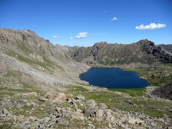
View of Lost Man Lake from Lost Man Pass
This hike traverses two scenic valleys with pretty lakes separated by a panoramic pass. From the pass wonderful views extend to the peaks and ridges of the Continental Divide, the Hunter-Fryingpan Wilderness and the Collegiate Peaks Wilderness.
See Trail Detail/Full Description
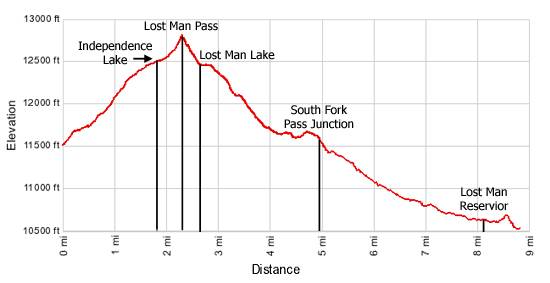
- Distance: 4.6 miles (round trip) to Lost Man Pass
8.8 miles (one way) to Lower Lost Man Trailhead (semi-loop) - Elevation: 11,520-ft. at Trailhead
12,810-ft. at Lost Man Pass
10,540-ft. at Lower Lost Man Trailhead (semi-loop) - Elevation Gain: 1,290-ft. to Lost Man Pass
-2,270-ft. to Lower Lost Man Trailhead (semi-loop) - Difficulty: moderate
- More Hikes in:
Aspen / Central Colorado
Why Hike Lost Man
The Lost Man trail provides instant gratification to anyone who loves traversing high alpine terrain with see forever views. Starting at 11,500-ft. off Highway 82 just below Independence Pass (12,095-ft.), the trail features some of the easiest access to an alpine wonderland of meadows and lakes anywhere in the area.
The trail begins with a moderate ascent along the nascent Roaring Fork River and then passes pretty Independence Lake before topping out at panoramic Lost Man Pass (12,815-ft.). Beyond the pass the trail drops to picturesque Lost Man Lake and then descends through beautiful meadows with great views of the Williams Mountains to Lost Man Reservoir and the lower trailhead on Highway 82, located 4-miles west of your starting point.
The hike can be done as an out and back or, with a car shuttle, a semi-loop. Please note that walking along Highway 82 to return to your car at the upper trailhead parking area at Linkins Lake is not recommended. Highway 82 is a very narrow road with little or no shoulder.
Elevation Profile
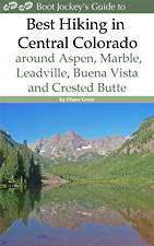
| Buy the BookThis opinionated guide includes all the hikes in the Aspen, Buena Vista, Crested Butte, Marble and Leadville sections of the website plus info on local services and nearby attractions. |
Trail Resources
Trail Detail/Full Description / Trail Photo Gallery / Trail Map
Basecamp(s) Information:
Aspen
Region Information:
Central Colorado
Other Hiking Regions in:
Colorado